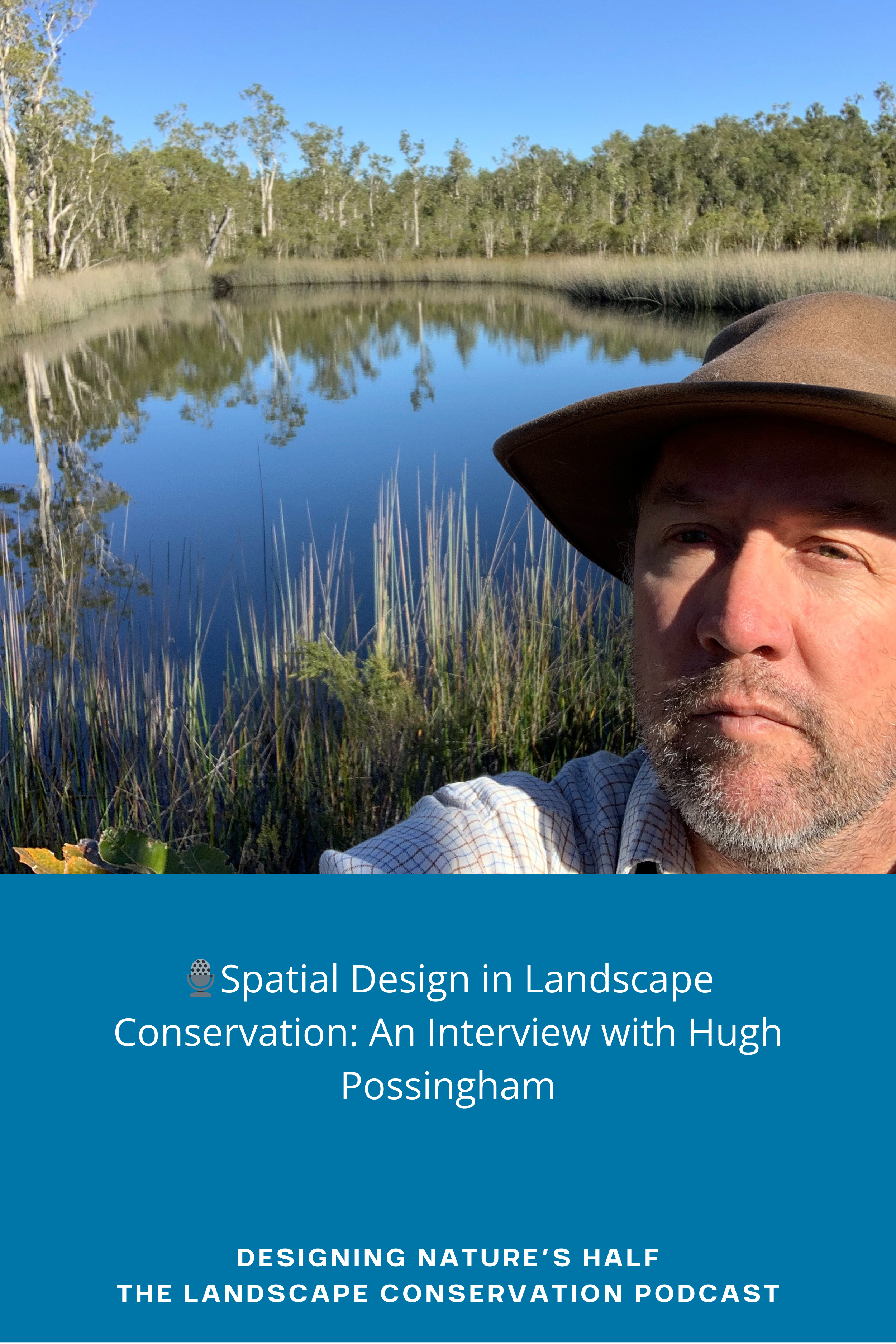
🎙️Spatial Design in Landscape Conservation: An Interview with Hugh Possingham
🎙️ Designing Nature’s Half: The Landscape Conservation Podcast
Key Points:
Spatial design is one of four key attributes of landscape conservation design, alongside convening stakeholders, assessing landscape conditions, and strategy design.
Guest Hugh Possingham is recognized as a pioneering figure within conservation planning, specializing in spatial prioritization.
Marxan software, created by Possingham’s team, has been instrumental worldwide in collaboratively identifying networks of priority conservation areas.
Biodiversity loss remains a critical issue globally; effective management and representation are crucial components often overlooked in protected area systems.
The challenge posed by invasive species highlights the importance of managing ecosystems effectively beyond merely establishing protected areas.
Funding gaps for biodiversity conservation could potentially be filled through corporate accountability, where businesses contribute to being nature-positive as part of their sustainability goals.
Innovations and Insights:
Systematic Conservation Planning: This approach includes various steps such as problem definition, implementation, and monitoring, and principles like representation and irreplaceability.
Multi-Disciplinary Stakeholder Involvement: Successful spatial design requires participation from non-specialists to decision-makers across different fields involved in landscape stakeholder processes.
Challenges Mentioned:
Declines in biodiversity continue at an alarming rate due to ineffective management practices that fail to focus on productive landscapes rich in species diversity.
There exists a significant funding gap between what is necessary for conserving biodiversity versus what is currently available through government grants and philanthropy.
Resources:
Hugh Possingham's Published Papers
Kunming-Montreal Global Biodiversity Framework
American the Beautiful: 30x30
For More Info:
…or participation inquiries, visit www.designingnatureshalf.com
Credits:
Research / Writing / Editing / Production by Rob Campellone & Tom Miewald;
Cover Art / Logo by Lucas Ghilardi;
Intro / Outro Voiceover by Tom Askin;
Music Composed & Performed by Aleksey Chistilin via Pixabay
Transcription:
[00:03] Intro/Outro: Mind Matter Media presents Designing Nature's Half: The Landscape Conservation Podcast, where discussions center around the most current and innovative approaches to landscape conservation and design. This is the show for stakeholders who want to adapt to the climate crisis, halt biodiversity loss, and change the world by designing sustainable and resilient landscapes through collaborative conservation action.
[00:39] Rob: Hey, everyone, welcome to Designing Nature's Half: The Landscape Conservation Podcast. I'm your co-host, Rob Campellone.
[00:49] Tom: Hi, I'm your other co-host, Tom Miewald. So, Rob, in this episode, we have the influential conservation scientist Hugh Possingham with us today. We're lucky to have him here. I was watching Biden's speech last night, and he mentioned 30x30, actually, and it was, to me, a watershed moment. You know, there's this global initiative called 30x30. And basically, the initiative is to try to protect 30% of the earth by 2030. So, how would you go about doing that? In a perfect world, we would have some scientific data and process and algorithm that would find a near-optimal solution that identifies a representative network that represents all biodiversity at the lowest possible cost. Wouldn't that be the dream, but in other words, some spatial design process? And this is one of the topics that Hugh has dedicated much of his career to addressing this issue.
[01:38] Rob: That's right, Tom. Spatial design is one of the four key attributes of landscape conservation design. The other three are convening stakeholders, assessing landscape conditions, which we discussed in our last episode with retired Chief Ecologist from NatureServe, Pat Comer, and finally, strategy design, the process of developing a strategic plan: one of the two essential products, or sets of products, results from the design process. The other essential product or set of products is a blueprint or a spatial prioritization. Today's guest, Hugh Possingham, is one of the founding fathers, if not the founding father, of spatial prioritization work. And we're really honored to have him here on the show today.
[02:33] Tom: Right. I'm very familiar with Hugh's work as one of the creators of the software algorithm. I'm not really sure what to call it. It's a spatial decision support tool called Marxan. So, there was a time in my career when that's all I did was get groups of people together and run Marxan analyses and run them for a collaborative to see if that represented their understanding of priorities on the landscape; as someone who spent countless hours putting together the input files and data sets to use the program and running it, and oftentimes getting vague error messages, but more often than that, creating outputs that were compelling and really made people think. I always found it more than a software tool. It was a process that got people sitting around a table and having a dialogue about what was important, how to represent those things with data, and consider the implications of that in the spatial design, the broader context. I always thought the foundational piece of Marxan and Hugh’s work was systematic conservation planning, which includes various steps from problem definition to implementation and monitoring. And there are some important principles for biodiversity planning, such as representation, irreplaceability, and efficiency of these important areas, and hopefully, we can dig into some of those concepts. But how this relates to our podcast is that it's dedicated to the art and science of landscapes and their conservation. And Hugh's work is really focused on that critical spatial design piece.
[03:54] Rob: When I think about the key attributes of landscape conservation design, which includes spatial design, I think of them in terms of the four cornerstones of innovation: people, purpose, process, and products. What do I mean by that? Well, first, who are the people that need to be involved in the attributes work? In spatial design, it's a multidisciplinary team of landscape stakeholders that may include non, specialists, specialist, and decision-makers. I'd like to hear Hugh's perspective on that, actually. Secondly, what's the purpose of convening those stakeholders? Again, in spatial design, it's to prioritize where landscape stakeholders will conduct their work out into the future because, admittedly, they can't fulfill the vision of a design on the ground overnight. Right? They need to plan their actions out into the future, and spatial prioritization can help them do that. Thirdly, what process will they use to fulfill their purpose? You alluded to it in your previous comment, Tom. In spatial design, stakeholders directly participate in the interactive prioritization process. And again, I hope Hugh will provide some perspective on that. And finally, what is the product or set of products that result from the process? In spatial design, it's, of course, a spatial prioritization or blueprint.
[05:30] Tom: Yeah, that makes a lot of sense, Rob. But first, let me give Hugh’s bio. Hugh Possingham is the Australian Biodiversity Council's Co-Chief Counselor and Chief Scientist of Accounting for Nature. He is a Professor of Mathematics and Professor of Ecology at the University of Queensland. He was the founding Director of the Australian Research Council Center for Excellence for Environmental Decisions, the National Environmental Science Program for Threatened Species, an Australian Research Council Professor, Laureate, and Federation Fellow. For years, he was The Nature Conservatory's Chief Scientist globally based in Washington, DC, and for two years, the Chief Scientist in Queensland, Australia. He has an honorary doctorate from the University of British Columbia and Adelaide University. The Possingham lab developed Marxan, the most widely used conservation planning software in the world, having more than 7000 users in over 180 countries to build most of the world's marine and terrestrial protected area systems, from the Amazon and British Columbia to the Sunda Sea and South Africa. He has co-authored over 740 peer-reviewed papers, including 35 in Science and Nature, and he has been a privileged mentor of over 200 Ph.D. candidates, honor students, and postdoctoral researchers. He is also known for one psychological disorder, a compulsive desire to watch birds…it sounds like…so it’s great to hear about that. Hugh, first of all, welcome to the podcast, and thanks for joining us from halfway across the world. You're located in Australia, and we're in the western US, so I think we did a pretty good job managing the time difference between our locales. Did I miss anything from your bio or anything else you'd like to highlight or add?
[07:04] Hugh Possingham: No, thanks, Tom. Thanks, Rob. Yes, that psychological disorder I shared; I think I share it now with about 20% of the planet…bird watching. So, it's a spreading disease.
[07:15] Tom: It's a good one. I enjoy it too. I'll gladly have that.
[07:19] Rob: Hey Hugh, thanks for joining us on today's show. Let's start off with a high-level discussion, if you will, about biodiversity conservation to solicit your perspective on how you think we're doing with that. Then, we'll shift to a few questions about spatial planning and decision science and its role in designing protected area networks. Finally, we'll wrap things up with a discussion about Marxan. How does that sound?
[07:51] Hugh Possingham: Sounds great.
[07:52] Rob: Our show focuses on large landscape conservation and using a design process to challenge the triple planetary crisis, advance the practice of landscape conservation and further adaptation, and the goal of sustainability. In my introductory comments, I outline the overall design process of convening stakeholders, assessing landscape conditions, spatial design, and strategy design, but given your decades of experience in the design realm, do you see any opportunities for revising that linear conceptual model, or does it do a pretty good job of summarizing the design process, which admittedly is an iterative and adaptive process?
[08:44] Hugh Possingham: I think you're right. It looks linear, but it never is linear. So, when we're involved in some large landscape design and blueprinting processes, the conversation always starts with the broader stakeholders. And that can be all the way from federal governments to local governments. It can be a whole heap of landowners, people who are resource users, and the general community, often particularly the First Nations people in those regions. I think Canada has been a great user of Marxan, engaging First Nations people in those decision-making processes. So those discussions happen. But as the process moves along and we get into purpose and decide about what we want to achieve…I don't think our Prime Minister has ever mentioned “30 by 2030.” But if your President is mentioning “30 by 2030,” that's a remarkable step forward. Broadly, that's a broad vision to represent 30% of every kind of habitat and species in a well-connected, efficient, ecosystem-protected area system. That's great. And then as one starts the planning process and decisions start to be made, what we generally find is we start cycling back to purpose again. So, it is a cyclical, adaptive management cycle. I think when it ends, and if it ends as you cycle around, partly depends on land ownership and particularly whether you're in the sea or on the land. So, with the Great Barrier Reef rezoning that we did, because it is actually federal government waters and state government waters, the decision can be made and the maps can be done. On July 1, 2004, the biggest systematically designed marine protected area in the world was created with Marxan. It's been a model for the rest of the planet, but that can't usually happen on the land. Clearly, in the land, it's an iterative process of protection acquisition and stewardship by the local community. Typically, those blueprints don't just suddenly happen as an act of Parliament.
[10:46] Tom: Right. Implementing a blueprint is definitely a longer, iterative process that probably takes many decades actually to implement. Of the ones that you've seen on the land, what has typically been the process there?
[11:01] Hugh Possingham: That's different from the marine system in some senses. Countries like Mongolia, for example, more or less did implement a set of plans relatively quickly. Mongolia. This is work led by Joe Kisika's team in The Nature Conservancy, probably now, ten or 15 years ago, they were determined to reach, I think then, a 20% goal higher than the 17% Aichi Target because Mongolia is largely rangelands and land ownership is broader. Government land ownership and the primary extractive industry that does have the biggest effect on nature is mining, it is really a matter of getting those stakeholders around the table and a lot of those major Mongolia protected areas, which actually gives Mongolia one of the best and most representative protected area systems in the world, and a shining example that was rolled out reasonably quickly. But there are other things. For example, I know when I joined The Nature Conservancy seven years ago, they'd already been using Marxan for ten years. They were one of the biggest Marxan users in the world in the 2000s, and every Conservancy chapter office had a Marxan plan, a blueprint, hanging on the wall, and they were using that as broad guidance. They were working at it iteratively, bit by bit, with easements, stewardship arrangements, and acquisitions. So, in that sense, the blueprint can sit there for a decade, being chipped away at with the community. So, I think it's horses for courses, right? It depends on the scale, and it depends on whether we're in a command-and-control ownership situation or we're talking about thousands of landowners and thousands of stakeholders.
[12:41] Tom: I'll take the next question a step back and talk about biodiversity conservation in general, and then over the conversation, we'll talk more about spatial prioritization and then talk about Marxan, but in terms of biodiversity conservation, what are some of the biggest issues and challenges that you're seeing from your perspective?
[13:01] Hugh Possingham: Yeah, great question. I mean, it's not going well. As a 17-year-old, when I wrote my first angry letter to the newspaper talking about the destruction of biodiversity, things have not gone well in the intervening 40 years, to be honest. We produced a threatened species index based on the World Wildlife Fund Living Planet Index. And whatever way you cut it, the abundance of most threatened species across the planet is going down about 2%. So, it's not just the extinctions. We get very upset when we hear about extinctions. I think what much of the general public is not aware of is just the overall decline of abundance, and that reflects a lot on spatial planning. So, part of our solution is building protected areas to stop habitat destruction. But there are two things about the Convention on Biological Diversity’s Target 3, about 30% by 2030, that Joe Biden mentioned. Those two things tend to get a bit ignored: 1) that 30 by 2030 has to be representative, and 2) that 30 by 2030 has to be well managed. They're little parts of the target that people ignore. And when we see the declines of abundance, what we're seeing is the most fertile and productive land, where the abundance of most organisms is at its greatest, is the stuff that's not being conserved because people like it. And that's why I think Marxan has been so important across the planet for over 100 countries because it's really focused people on getting a target for every habitat type and every species. That's more or less the first question it asks you: do you want to conserve 20% of every habitat? Do you want to preserve 30% of every habitat? Do you want to preserve 50% of particular threatened species? All those things get locked into the software early on, which makes and delivers solutions that are well connected, which previous software did not do, and also cost-effective, actually minimizing the impact on others. So, it really is a recipe book for delivering an outcome that is a bit like an outcome for a company. I want to make a profit. I want to grow and deliver to my shareholders 8% profit per year. So it's a target like that, and it's kept many countries focused, whereas the danger, if you don't use those spatial planning tools, and this is why I think biodiversity is in decline in so many places, is they'll say, we're going to build our protected area system, we may ultimately get 30%, but what we're going to do is we're going to conserve some deserts, we're going to conserve some mountaintops, we're going to conserve all the infertile soils, and we're basically going to ignore the productive landscapes. And I think the overall global decline of biodiversity is tied to that failure to focus on representation and productivity.
[15:49] Rob: What efforts are particularly innovative and or effective, maybe beyond Marxan, in addressing this issue of biodiversity loss?
[16:02] Hugh Possingham: Yeah, really good. And this is going to be very triggering and controversial for many of your listeners in the northern hemisphere. I think you both know that the conservation science and social science literature is dominated by people who live in North America and Europe. Probably 70% of all the scientific publications in our space come from those places. But without being too pejorative, the ecology of those areas is very, very different from the rest of the planet. Very, very different. And in particular, many of those ecosystems are quite resilient relative to, say, tropical rainforests or Mediterranean shrublands, where most of the biodiversity is. Most of the biodiversity is in the tropics and Mediterranean ecosystems, which have a completely different ecology. Now, some Californians will understand Mediterranean shrublands and the people of southern France, but not many of these people have a deep and full understanding of tropical rainforests and subtropical systems, which, really, those ecosystems move to the beat of a very different drum. Those northern systems are very resilient, and I think I can see that Canada and the United States have quite a lot of success in recovering threatened species. Partly your Endangered Species Act in the United States, Europe is recovering species, but we're talking about many systems that were actually under a pile of ice 20,000 years ago. The rest of the world was not, and those systems are far more fragile. Things like invasive species, for example, are one of the biggest threats, whereas they're not so much a threat in those northern latitudes. To give you another specific example, there are estimates by, again, North American scientists, often that possibly as many as 1000 different bird species were wiped out on Pacific islands. A thousand, that's almost 10% of the world's birds, were wiped out just by the arrival of people, rats, and pigs colonizing islands. So, Australia is a continent, but it behaves like a big island. So, we can go and protect a whole heap of areas. But if we don't deal with invasive species, then, and that's the cause of most of our current extinctions, it is largely invasive species. We don't manage those issues. We don't have resilient landscapes. We don't have landscapes that can deal with those invasives nearly as well as those northern landscapes. So, the narrative and the conversation, I think in tropical ecosystems and many southern temperate ecosystems are very different. And it is all, again, about the management of those habitats. And if you get 30 by 2030 and you don't have the resources to manage it, well, then you've achieved nothing, to be honest.
[18:54] Tom: Right. In terms of achieving things, one of the big obstacles that we have in the conservation world is there are not enough resources. The funding gap between what is needed and what we have through. Typically, it's government grants or foundations. It's not going to meet that gap. Do you see any alternative ways to meet some of those goals? Is that what Counting for Nature is trying to do? Maybe I’m just trying to understand what you think the future of that issue is? And are you working on anything associated with that?
[19:24] Hugh Possingham: Yes, certainly. You're exactly right, Tom. So, we did some work here in Australia in one of my centers, and Brendan and a whole team of us produced a paper to work out if really, we really wanted to stop extinctions in Australia. And currently, we're still losing a mammal and a bird a decade, literally a different species or subspecies of mammal or bird every decade, which is quite appalling for a very rich country. If we wanted to stop that, we'd probably need around two or 3 billion Australian dollars a year, which sounds like a lot, but actually, it's not a lot, given we have a military that spends that every week, and I don't even know who our military is fighting or defending us against. So that's the amount of money. So, you would have thought I had spent 40 years yelling at the government at a state and federal level in this country and other governments around the world, saying, “Spend more money!” That hasn't happened. There has been no increase in environmental spending in most countries in the world, and it certainly hasn't happened in Australia. So, therefore, I joined The Nature Conservancy. They have a fabulous model and they have a lot of philanthropy, but they, too, had done that analysis. So, philanthropy can probably fill 10 to 20% of the gap, but we've probably pushed that as far as possible. Of course, The Nature Conservancy, Wildlife Conservation Society, WWF, and Conservation International have all achieved amazing things around the world, but I would still say we're five times short of what we need. So, then people say, “Well, what about business? What about the people, the businesses and the stock market is actually sustained by nature. If there is no Dow Jones…if there aren't any ecosystem services and there's no biodiversity, can't they pay to support the natural infrastructure that drives their prosperity?” So that's how we now have this Task Force on Nature Related Financial Disclosures, which is really strong in Europe, but it's spreading around the world, where every company, in theory, is going to pay to be biodiversity positive, just like they're paying to be carbon neutral or carbon positive. And that's what Accounting for Nature is all about. It's a not-for-profit company that develops standards for biodiversity accounting and accredits accounts to meet those international disclosure mandates. Hopefully, in the next ten years, every major company in the world will have to produce a set of audited books, much like their financial books, that say we are nature-positive. It could be Coca Cola, it could be BHP, it could be Rio Tinto, Exxon, whatever. And they'll say, if you want to deal with us, you can, because we're biodiversity and nature positive. And to do that accounting, I think you full well know we could do another hour episode on that. That accounting is extremely difficult because biodiversity is so complicated. But so that's our hope. To be honest, I don't know if it's going to work, but the other two haven't solved the problem, so I have to try a third one, right?
[22:32] Advertisement: What if we could rescue the planet from the ravages of the climate crisis and, in the process, save a million species from extinction? Would we do it? Former U.S. Fish and Wildlife Service Senior Policy Advisor for the National Wildlife Refuge System, Robert Campellone, explores the United States' most pressing conservation challenge since Rachel Carson's Silent Spring, the triple planetary crisis: pollution, climate boiling, and biodiversity loss. In Designing Nature's Half: A Practical Guide to Conserving 50% by 2050, Campellone reveals previous nationwide initiatives to design sustainable and resilient landscapes, provides an easy-to-follow “how-to” guide for taking a collaborative, science-based approach to identify conservation actions across large landscapes and advocates for taking a third nationwide try to design nature's half. Learn how to take a synergistic approach to mitigating the climate crisis and conserving biodiversity in Designing Nature's Half: A Practical Guide to Conserving 50% by 2050, and be part of the global movement to save the planet. For more information, visit www.designingnatureshalf.com.
[23:46] Rob: Let's shift gears to spatial planning and decision science in protected area networks for our listeners who might be new to the idea of designing protected area networks. Can you clarify what we mean by protected areas? I mean, are we specifically talking about national parks and designated Wilderness areas as protected areas, or are we talking about a fuller suite of conservation lands that might include resource extraction areas or other working lands like ag lands?
[24:25] Hugh Possingham: Yeah, and I think you're exactly right. 50 years ago, it was all about national parks and what you'd call IUCN (International Union for Conservation of Nature) Level One and Two Protected Areas. These are almost entirely focused on conservation, with no extractive use. Now, I think we're taking a broader view, partly because of that financial issue. Countries can't just have the most countries; very few countries can say 30% is going to be national parks. The money's not there to do that. Maybe a couple of European countries could afford that. So, it's got to be sometimes some multi use protected areas. The International Union for Conservation of Nature, as you know, has those six categories, and many of them allow some use, particularly tourism, but there might be some grazing. And in many ecosystems, grazing is completely compatible with nature. There may even be some extractive use, open-cut mines in protected areas, but some localized mining with high levels of control and even some timber extraction. I mean, the key purpose of these broader scale protected areas and this whole of landscape planning that you're talking about is all those impacts are mitigated, and you really want everything to be nature-positive. So, if you are doing some form of timber extracted from a broader landscape that provides us, of course, the wood builds our houses and furniture, then you need to be monitoring it and be sure that whatever species are there, whether it's spotted owls or Leadbeater, possum or other species that are very sensitive and require old growth forests, you need to be sure that those species are stable and or increasing. But if you can guarantee all those things. I'm all for multi-use.
[26:08] Rob: Can you also explain why designing protected area networks rather than individual sites is important?
[26:16] Hugh Possingham: Very good question. So why do we have software like Marxan and Zonation, and other sorts of software to help us build these protected area systems? Why can't we just, what happened in the old days, find those particular places which might have a waterfall or a mountain or a particular threatened species, or be beautiful places that we want to preserve? We found that when we did that, we failed to meet these overall biodiversity conservation goals. We tended to overrepresent areas people didn't want for other purposes, like cities and agriculture. So, the main reason to have these spatial planning tools is that they enable you to evaluate and understand an entire protected area system, which delivers representation, which means you're trying to protect every kind of habitat and every kind of species also in a way that is really well connected. So, connectivity. An individual site doesn't have any connectivity. It's its own site unless it's gigantic. So those individual sites, their value is, as you know, enhanced by connectivity with other sites. That means the whole is much more than the sum of the parts, which means that entire protected area systems can only be evaluated and planned for in their entirety. Entirety. It's a bit like if you wanted to build the perfect car, you could go to the junkyard and grab the best pieces of various cars. So, you might get a Mercedes Benz engine and you might get a Volkswagen chassis, and you'd construct this car from the best possible pieces. And, of course, the car wouldn't work. The engine wouldn't fit inside the car, the steering wheel wouldn't connect, and the suspension wouldn't work. When you design a car, it's like designing a protected area system. The whole thing has to be designed as an interconnected thing. It's not just a matter of picking up the best possible pieces. So that's what spatial planning is all about. That's why design, as you say, and having these blueprints isn't so important, and why having a vision like a target three of 30% of every ecosystem type that's representative, well connected, and well managed is so important. And I suppose the other thing that most of the modern software does is try to achieve all those goals in a way that annoys as few people as possible. As I often say with the Great Barrier Reef, that protected area system 20 years ago roughly conserved 20% of every single kind of habitat type. Probably the most representative reserve system ever created in the world was only possible because we avoided those places which were heavily used by industry, particularly the fishing industry and the recreational fishing industry because if we hadn't, the protected area system would have never happened. If you try and go head-to-head against highly profitable and influential industries like mining, fossil fuels, agriculture, and fisheries, then basically, you're going to lose because the environment is still lower down on the priority list. But if you actually try and achieve your purpose and your goals in ways that make some compromises, you can get away with it and you'll get a successful protected area system.
[29:34] Tom: That's the concept of efficiency and meeting goals at the lowest possible cost, whatever cost might be. Maybe it's financial, maybe it's something you want to avoid, but that's kind of that concept embedded in there. Anybody with data and knowledge about conservation could sit at their computer and run Marxan and develop a protected area network. But it may not have kind of the impact that you might want unless there's a group of people that is also involved and co-produced with a group of people. Is that what you found? What would be your guidance on the people you want to involve in a Marxan-type analysis?
[30:15] Hugh Possingham: Well, everybody who has an interest in that area, which is a huge group of people. I mean, I think one key thing is specialists often did the old style Marxan analyses because Marxan was hard to use. It's always been free, but it's also been tricky to use, as you full well know, Tom. Therefore, it often meant well. One of the best examples, which was multiple users, was done by Sati Amay around 2002 2003 in the Channel Islands off Los Angeles. And she actually did run Marxan. And then she returned to a group of stakeholders, which was people from six or seven different groups, including First nations people, fishermen, different groups of fishermen, conservationists, and they would do the planning. She'd run the analysis overnight and come back and say, this is what's going on. And that was a very, very successful process of engaging all those stakeholders. Of course, this is a scale issue often, isn't it? So, in that case, she felt she could get all the representation from all the stakeholders around the table. Once you start getting to bigger areas, or let's say some of the work we've done in Malaysia off the top of Sabah, where you've got people in remote communities, then getting everybody around the table becomes more and more difficult. They would need to send representation to those discussions. Now, we've just released a new version of Marxan called Marxan map, that runs off the cloud. And instead of taking a week and a half or two weeks to plan, that is probably what took you, Tom, you could do one in an hour and a half, and you can run it there in front of everybody. There's a very, very schmick interface that Jennifer McGowan, Microsoft, and TNC have produced over the last three or four years. This means we've effectively democratized spatial planning, whether you like it or not. So, the plan is now that as every country builds their 30 x 30 plans, they can do it in a much more inclusive fashion. The data can be stored on the cloud. People could run it from their own laptop, or they could run it in a group, and they could discuss it in a collaborative fashion because it's all basically open. Software is open, the data you're using is open, and hopefully we will see a lot more of this collaborative spatial planning. As long as people agree on these fundamental purposes of 30 by 2030, representation and well managed, then I think we have a great opportunity. Their previous national biodiversity strategy and action plans actually were not very definitive. They had no maps, and they weren't clear about what they would achieve. And that's why many countries didn't reach those 17% goals. So, let's cross our fingers and hope that this is easy enough for those governments and people to use and that we'll get our 30 by 30 dream.
[33:02] Rob: Tom and I often talk about how you engage the stakeholders within those geographies to be a part of it. And I'd really like to hear if you have any innovative thoughts on that.
[33:15] Hugh Possingham: Well, I think, in the end, it takes time. I mean, the most important thing to realize is even though we can assemble the data now and run the software in literally hours from scratch, in terms of your four steps, that is now the fastest, quickest, and most trivial step in many ways, gathering people to talk about the vision, the purpose, and the goal. That can take at least two or three years. So, in all my work, which is using decision science for conservation, often it'll be allocating funds to threaten species dealing with invasive species. So, it's not a protected area or spatial planning. That first issue, what do we want to achieve? What is our purpose? Or, as a mathematician, I'd say, what are our objectives and our constraints? That's anywhere from a one to a five-year discussion, something that sometimes governments try to run sometimes not-for-profits try to run. Ideally, it comes bottom up from the community, but it is by far the slowest process, by far the slowest process. And it has to be slow because everybody has to be on board. The most important people to have on board in many countries are First Nations people. So, all those discussions need to take time, and people need to understand what they're doing and why they're doing it. With more and more success in those sorts of bottom-up-driven discussions. Yes. So how long it takes is very specific to the circumstance. Again, is it run by the government? Governments aren't always the friendliest people for running discussions and consultations because they're highly bureaucratic and highly structured. Sometimes, people don't trust governments. So, I think it's ideally a mixture of not-for-profits and governments and the community driving the process themselves. I mean, I look to a future where I would hope more and more community groups are actually building their own plans and saying, well, we've done some planning ourselves, so we've familiarized ourselves with the concepts of representation and efficiency and connectivity, and this is what we'd like to bring to the table. And then rather than them being hit with all this technical stuff and all this jargon, they actually start having done some planning themselves, and then they can enter their discussions on an equitable footing because equity is now a big issue and procedural equity and information equity should be part of a decision-making process. My view is that stuff like Marxan, really the software itself, is not at all important. It's the questions that the software asks you to answer that are important. How connected do you want the system? When we say representing 30% of every conservation asset, like a species or a habitat type, is that really what you wanted? What do you think a habitat type is? When we say species, is that just birds and mammals and vertebrates and plants, or do you want to go further? Or is it habitat types and who made the habitat map? So, they're all often very important discussions that I would like to see the community being involved in. Yeah.
[36:11] Tom: And that reflects my experience too using Marxan, where you spend a lot of time working with groups to identify what are the goals, the objectives, the species of concern, and then it leads to discussions about how much and how you want to connect those things, and it leads to iterations, and it leads to a productive dialogue about the landscape and what's important. I've always been really fascinated by how Marxan works, and it's really held its own in terms of being used globally, and it's still being used, and it's great to hear about the new Marxan map that will democratize the use of Marxan. I think that is just great to hear. Marxan, in my mind, does one thing really well, and that's finding near-optimal solutions to biodiversity conservation at regional know. We've talked about Marxan a bit. Maybe for our listeners, we should methodically take Mark San apart a little bit how it works, and why it was developed. Could you give a little bit of history on that?
[37:09] Hugh Possingham: The full story of the development of the mark sand could take me an hour, so I'm going to try and keep it quick and short. In some senses, like almost everything in science, it's an accident. It's an accident of the fact that I was involved in the early 90s in regional forest agreements, which was an attempt, a bit like the Pacific Northwest, to rationalize forest use with respect to threatened species and ecosystems. And that happened all through the late '80s and -'90s. David Lindenmeyer and Charlie Zammet were involved in providing science and CSIRO to help resolve the conflict between forestry and biodiversity. And the federal government said, well, we need a spatial planning tool that deals with all this. And I had a PhD student, Ian Ball, who didn't have a scholarship and had no resources. So, I said, well, Ian, I don't know what. He was a very good coder and a very smart mathematician. I said, I don't know really how we're going to support you, but if we take this government contract, we'll be able to get your PhD. That's what he means. It was half of his PhD, building this software and doing those first marks and analyses, which was then called Spec San. And then many things happened after that. TNC weighed in with some support, and then the Great Barrier Reef Marine Park Authority came to us and said, well, you've got this software. Will it work in the sea? And we said yes. And that's when it changed its name from Spec San to Mark sand, because they, you know, this is built for forests. It can't work for the ocean because of the ocean's special. Well, the ocean is special, but all the principles of conservation planning, we've just been talking about efficiency, representation and connectivity all work in the sea and the land equally well. So, we did re-engineer it a little bit. We renamed it, and basically, it's gone on from there. I suppose the reason why it has had some longevity is it's always been free, and there's never been a commander-control approach to it. So we've had lots and lots of contributors from all over the world, particularly at the moment. Dr. Jennifer McGowan has organized the Marxan map platform. And a lot of this is voluntary labor from scientists all around the world. Boards, committees, people running manuals, people doing add-ons, people running. There are 400 papers that use Marxan, 400 peer-reviewed scientific papers that use Marxan, and 20 are mine, not mine that I'm involved in, but hundreds of people have used it. And then there are thousands of plans that are in the gray literature that are sitting in the offices of the environment department in Fiji or Papua New Guinea or Colombia that we probably will never know about that use Marxan. So, I suppose building a community is really, really important and making it all open so anybody can contribute to Marxan, anybody can use it, and anybody can discuss how it should develop into the future. The only problem with all that is because we've never charged for it. We've often trained people at cost or below cost. The continued funding of this software is always a challenge, and we've never really had a lot of major support from the big environmental funders. Microsoft's been great, the Nature Conservancy has been great, and other organizations have been great, chipping in bits and pieces to progress things forward.
[40:16] Rob: What are some of the best uses you've seen of Marxan?
[40:20] Hugh Possingham: That great barrier Reef rezoning was spectacular and did deliver very good representation, but it didn't have a lot of connectivity in there. We can deal with connectivity a lot better. The examples all through Indonesia have formed their spatial plans. I gather that the Brazilian protected area system was done, but it's in some reports in Portuguese, and my Portuguese is a little bit thin, I should say. It's non-existent. South Africa is probably the country in the world that uses spatial planning almost more than anybody. They have many of their local government areas run sort of Marxan or, in some cases, C-Plan spatial plans, and they use that to decide where development can or cannot occur. So, I mean, many of them I don't even know anything about which. It just reflects my commentary about command and control. We don't care who uses it. We don't control how they use it. We're willing to answer questions and help people use it. And the fact that so many publications are out there means it's accessible for technical people, whether they've all been perfectly implemented. No, of course, they're not because the ultimate decision about where protected areas go is highly political. So, to give you a bad example, ironically, the Australian federal government chose to build a marine protected area system for the entire country, which is gigantic. It's the size of Australia; it's the size of Europe, Australia's exclusive economic zone. And for various reasons, they decided not to use systematic planning tools. And this is long after the Great Barrier Reef was rezoned. This is in the. So, they went a nonsystematic route, and they ended up with a protected area system that is very nonrepresentative and relatively useless. So, you can still have countries and governments doing incredibly stupid things; despite they have all the software, all the technical support, and all the expert advice they could ever want, they'll go ahead and make protected area systems that make them look good, say, well, we met our 17% goal, each target goal by the date, but are, in fact, very, very poor protected area systems.
[42:28] Tom: How do you work within that context of getting multiple stakeholders to look at the blueprint and make it known that this is a valuable piece of information to support their individual planning across a landscape? We will never have a top-down situation where we will implement this. Maybe in Mongolia, that could work.
[42:47] Hugh Possingham: I mean, I think that's where the environmental NGOs and independent scientists are really, really important because they keep at these things, and they push, and they push. So, I give another talk about the impact of science on policy and management. And basically, you can do all this science and you can publish it, and you can talk to governments, and you can advise governments, and you can turn up to meetings and Senate inquiries forever. You really have to wait for stars to align so the plans can be there, they can be done, and they can involve stakeholders. But these moments in time, like Mongolia, like the Great Barrier Reef, like what happened with South African planning, what's happened in the North Sea, a lot of British Columbia, the stars align, and suddenly the plan goes through. And that moment might last nine months. And sometimes it's very hard to know why. So literally, you're pushing on this door that's locked, and you keep pushing, and sometimes you think it's opening, sometimes you think you have your foot in the door, and sometimes nothing happens, and suddenly, bang, you're in, and then you're away, and it all gets done, and then you never knew why that happened. So, I know that doesn't sound very scientific, and I'm sure a political scientist and a social scientist who is much smarter than me would be able to explain and understand it. I know you have to keep pushing, and that's why a lot of these long-term NGOs, environmental NGOs, are so important because they keep pushing and they keep pushing. And as long as they stick to those scientific principles. You don't want them to stray and say, oh, we'll take this huge area of desert and reach our 30% goal with land and sea. That, in fact, is not at all contentious. That's where things get dangerous because then countries can tick off their 30 x 30 goals and not have a representative, well-managed system.
[44:34] Rob: Well, Hugh, I'm afraid we're running out of time, but it's been great having you on as a guest. We really appreciate your time and the information you've shared. Do you have any parting thoughts to share with our listeners?
[44:48] Hugh Possingham: In many ways, the software itself is unimportant. The answers it produces by accident produce multiple answers. Give people some choices. But the most important thing is the software for you to use, it asks you a common set of questions. So, it's like a coffee table. You're sitting there around the table, and it's focusing all the stakeholders together, and they have to say, what do they care about? Do they care about connectivity? What parts of the landscape do they really want to protect? What parts of the landscape don't they want to protect? And what is understood by representation and efficiency? So, in some senses, the software and the answers are less important than it is, like a way of bringing people together around the table. And I think that's often poorly understood in decision science. People focus on the math and the algorithms, but in fact, it's more a social process that the software helps drive as much as the technical process.
[45:45] Rob: Tom, do you have any parting thoughts to share?
[45:48] Tom: I want to thank Hugh for his career and the work that he's done on Marxan systematic conservation planning and for taking the time to talk with us today. I hope people who are thinking about 30 by 30 are listening and thinking about using some of these tools to support good planning.
[46:05] Hugh Possingham: Thanks, Rob. Thanks, Tom. It's been a pleasure. Great questions.
[46:08] Rob: Thanks again to our guest, Hugh Possingham, and thank you, our listeners, for tuning into Designing Nature's Half: The Landscape Conservation Podcast. I've been your co-host, Rob Campellone.
[46:21] Tom: I've been your other co-host, Tom Miewald. Please join us every two weeks for another informative episode of Designing Nature's Half: The Landscape Conservation Podcast.
[46:35] Intro/Outro: Designing Nature's Half: The Landscape Conservation Podcast is researched, written, edited, and produced by Rob Campellone and Tom Miewald. Lucas Gallardi created the Designing Nature's Half cover art and logo design. Tom Askin is the voice behind the intro and outro, and the music was written and performed by composer Alexei Cistlin via Pixabay. Designing Nature's Half: The Landscape Conservation Podcast is a proud member of Mind Matter Media, a startup multimedia network whose mission is to change the world by designing sustainable and resilient landscapes for people, planet, and prosperity.
An Invitation
If you think you have something to offer to the conversation and would like to be a guest on our pod, drop me a note at: info@lcdinstitute.org and put "Guest" in the subject line.
Sharing is Caring
Please consider sharing this newsletter with your social contacts so we can build a community of folks who want to turn down the boil, save our planet, and its inhabitants.
Join the Designing Nature’s Half Community
Sign up below to hear about what we have up our sleeves to save the planet and learn how you can get involved.

A man and his mic — where the magic happens.
Thanks for your interest and support!
Until next time,
Dr. Amanda Sesser, the Coordinator of the Southeast Conservation Adaptation Strategy (SECAS) Partnership, discusses the need for inclusive design and decision-making processes that involve diverse stakeholders and empower communities. By bringing together various sectors of society, such as transportation, energy, and conservation, sustainable landscapes can be co-designed, created, and managed for people, planet, and prosperity. The episode emphasizes the need to balance human well-being and ecological integrity – a challenge that requires a new governance model that breaks down silos in traditional planning and decision-making. It addresses historic patterns of inequality and injustice to create a more inclusive and equitable society and highlights the concept of reciprocity and the importance of engaging indigenous and other disenfranchised people.