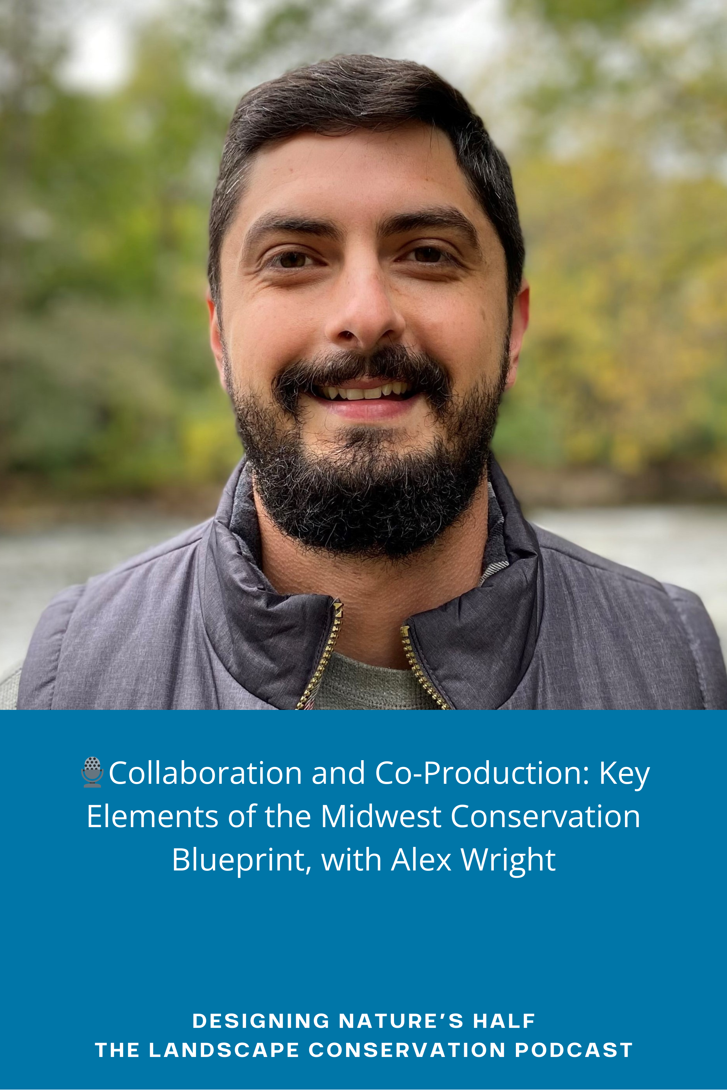
🎙️Collaboration and Co-Production: Key Elements of the Midwest Conservation Blueprint, with Alex Wright
🎙️ Designing Nature’s Half: The Landscape Conservation Podcast
Key Topics Explored:
The goals and collaborative nature of the Midwest Landscape Initiative (MLI).
How MLI bridges gaps across various stakeholders - moving beyond traditional terminology towards more inclusive community-building language.
Challenges faced when working amidst fragmented habitats due to heavy urbanization or agricultural use within Midwestern states.
The Role of Technology & Data:
Introduction to 'Midwest Conservation Blueprint,' an essential base map aiding regional priority-setting for land & water conservation efforts.
Discussion on how data-driven approaches inform iterative updates to these blueprints, incorporating public feedback as well as expert insights.
Success Stories & Practical Insights:
Strategies employed by MLI including rapid prototyping processes ensuring annual improvements based on user engagement and scientific advancements.
Resources:
For More Info:
…or participation inquiries, visit www.designingnatureshalf.com
Credits:
Research / Writing / Editing / Production by Rob Campellone & Tom Miewald;
Cover Art / Logo by Lucas Ghilardi;
Intro / Outro Voiceover by Tom Askin;
Music Composed & Performed by Aleksey Chistilin via Pixabay
Transcription:
[00:03] Intro / Outro: Mind Matter Media presents Designing Nature's Half: The Landscape Conservation Podcast, where discussions center around the most current and innovative approaches to landscape conservation and design. This is the show for stakeholders who want to adapt to the climate crisis, halt biodiversity loss, and change the world by designing sustainable and resilient landscapes through collaborative conservation action.
[00:32] Rob: Hey, everyone. Welcome to episode eight of Designing Nature's Half: The Landscape Conservation Podcast. I'm your co-host, Rob Campellone.
[00:44] Tom: Hi there, everyone. I'm your other co-host, Tom Miewald. So, Rob, who do we have on deck this week?
[00:49] Rob: We have a really exciting episode ahead, Tom. We have Alex Wright with us today. Alex is a Landscape Science Coordinator for the US Fish and Wildlife Service (USFWS), Science Applications program in the Midwest Region. In that role, he facilitates partnerships and develops tools to help coordinate voluntary conservation actions and investments across the Midwest vis a vis the Midwest Landscape Initiative.
[01:19] Tom: Well, Rob, you know, one of the first guests that we had, actually, it was, our first guest was Robin West. He was another U.S. Fish and Wildlife Service hero employee, much like we have here with Alex. In contrast to Robin, he worked in this wide-open space of Alaska, where some of the wildlife refuges are the size of some of our states. And Alex works in an equally challenging landscape but very different. The human footprint is light in Alaska, but in the Midwest, as I know, it's difficult and sometimes it's impossible to get away from the human footprint and focus on conservation. Maybe. But I'd love to hear some of those stories and what's evolved through the initiative that Alex is leading. I'm familiar with the geography. I grew up in Nebraska, and I know a challenge and an opportunity for conservation. And so much has been farmed. There's been heavily urbanized, especially if you go out further east. But it's great to see that whole system mapped out, and we'll dig into the interview, hearing about what that means for management and conservation. And I look forward to hearing about the Midwest Landscape Initiative, Rob, and how it can make a difference in broad landscape conservation. I worked in science applications myself in that program for several years, and I know it's home to some innovative thinking landscape approaches mainly focused on science and landscape mappings. So, really looking forward to hearing what the latest is here.
[02:36] Rob: This should really be interesting, Tom, because we're speaking to a second generation of Fish and Wildlife Service employees doing landscape conservation design. When you and I were with the service five years ago or so, you know, landscape conservation design was just really kind of finding its legs. And we were working together along with others, of course, to stand up the initiative. And there was a lot of uncertainty about what it was; what did we mean by it? What is this design term? How come we're not using the planning terminology? A lot of questions back then. But still, folks like Alex were early adopters and, and began to run with, began to work with their partners through the landscape conservation cooperatives and began to do that early initial landscape conservation design work. So here today, we have this wonderful opportunity to hear from Alex, a second-generation designer, if you will. And I'm really looking forward to this conversation. Tom, if you can't tell.
[03:51] Tom: Yeah, no, that's great, Rob.
[03:53] Rob: So anyway, yeah, you know, the MLI started in 2018, and it's a collaboration of the Midwest Association of Fish and Wildlife Agency member states, the U.S. Fish and Wildlife Service, and the US Geological Survey and others. The partnership is working to identify shared landscape scale fish and wildlife conservation and management priorities that require developing scalable, collaborative solutions to achieve healthy, functioning ecosystems. But don't take my word for it. Let's hear from Alex. Welcome to the podcast, Alex. It's good to have you here.
[04:35] Alex Wright: It's good to be here. I really appreciate the opportunity to have a chat with you and Tom and hang out with all your listeners today.
[04:42] Rob: Did I miss anything from your bio that you want to add or highlight?
[04:48] Alex Wright: I think you covered it really well. The way I describe it to people is I do all things collaborative landscape conservation. In that role, I work with diverse groups to define and reach shared landscape goals. Tom was kind and generous enough to compare me to someone like Robin West, who I really appreciated that episode you all had with him. I hope to have as impactful in a prestigious career as he did. But I think you're right, Rob. I am in that second generation of collaborative landscape conservation practitioners within the Fish and Wildlife Service, and I am just really excited to share with you both how that looks today.
[05:22] Tom: That's great, Alex. So, let's talk about the Midwest Landscape Initiative. Can you describe it to our listeners from a very high 30,000-foot level?
[05:31] Alex Wright: Yeah, I think Rob had covered it pretty well. It's just really a place for people to come to a table, gather around the table, and discuss around a table about how we are going to solve some of our biggest global challenges to the conservation and the health and the connectedness of our lands and waters. Tom, you mentioned a little bit about Robin's geography in Alaska and how different it is from the Midwest, particularly where you grew up in Nebraska. And there's so many different users. I don't love the word users or stakeholders because it brings us all in from our own individual perspectives on the landscape, but reflecting. We're all a bigger part of a community. But within the Midwest, given the fragmentation and the population sizes and the kind of diversity across the landscape, it really does require bringing so many different types of people together to work in alignment if we're really going to solve things like climate change, habitat fragmentation, invasive species, and so on, so forth. Of all the global, complex, wicked problems we deal with today.
[06:34] Rob: Yeah, let's pull on that thread slightly. Alex, for our listeners who may be in a young partnership, a young collaborative, or possibly even thinking about standing up for themselves or with their landscape stakeholders, can you talk a little bit about the partnership's organizational structure, how it operates, and how it organizes its work?
[07:02] Alex Wright: There are two ways to address this question. There's the conceptual approach to our structure, and then there's the actual manifestation of that. And maybe I'll start with the manifestation at the top. I mean, I think when you think about the Midwest Landscape Initiative, it is very tiered and hierarchical. And at the top, it's really a space for executive leadership from the agencies who have public responsibility for the health of our lands and waters. And in this case, coming from the US Fish and Wildlife Service, many of these relationships are based on our fish and wildlife agencies. While they're the kind of core guiding coalition of the work that we do, we have a structure of a lot of different working groups and committees actually to help lead to positive change on the landscape. And that participation is open to anyone. We love to say that these are open meetings that anyone can attend and open working groups for people to participate in. So, while the direction is set by executive leadership, again, from the agencies who manage these resources for the public good, anyone can participate, anyone can be on board, and anyone can contribute to a shared vision of healthy lands and waters across the landscape.
[08:13] Tom: So, let's talk about some of those working groups. I think that's a great model, breaking down from the different tiers and then into the working groups. So, my understanding is that you spend a lot of your time coordinating the habitat working group's contributions to the overall effort, and that includes a focus on the Midwest Conservation Blueprint. Could you tell us a little bit about that, both the working group and who's in that, what that looks like? And then how does that meet the goals and objectives of the conservation blueprint? And if you need to talk about the blueprint. Yeah, go ahead.
[08:44] Alex Wright: Yeah, maybe I'll start with what the Midwest Conservation Blueprint is, Tom, because this group really is fundamental to stewarding that work, and it's just a base map of priority lands and waters for conservation across the region. So, who makes up that group? It's a diverse set of conservation practitioners across the region that spans multiple different types of organizations, predominantly state and federal agencies. And that group really does guide the work, the technical work of the Midwest Conservation Blueprint, and how that fits into this bigger picture. Rob was asking earlier about kind of advice and ways to think about structuring folks who may be in early collaboratives or thinking about putting them together. You know, how we look at the Midwest Conservation Blueprint in relation to the partnership? It's really just a reflection and a manifestation of the partnership, and we always want to focus on those relationships first. That's why the working group is so core to the work, which is developing strong relationships across practitioners across the region to help develop the technical tools so that we can collaborate better with all the diverse community members that we have in our region. So, as I said earlier, the partnership in the MLI really is a convener, a connector, and a bridge builder. And really, the most important tool we believe we have is a table for the listeners there. You can imagine me banging on a table right in front of me to illustrate how important it is to have a space for people to come together, gather, share ideas, and drive direction. We look at things like the blueprint, the science and technology that aids in bringing people to the table, gathering around the table, and finding ways to work around the table. So that's really what that working group is about, is building those strong relationships across the region and developing the science and technology that allows us better to coordinate voluntary conservation actions and investments across the region.
[10:40] Rob: When Tom and I think about landscape conservation design, which leads to the development of a blueprint, kind of like the process, if you will, that ultimately leads to a blueprint or a design. We think of the first attribute of the design process as this idea of convening, and we use the term stakeholders, but I recognize the challenge with that term, as you mentioned earlier, Alex. If you have a better term for us to use, please share that, and we'll pick that up…but this idea of convening stakeholders, bringing them together, having them express their interest, their values, their vision for the landscape that they live, work, and play in, and continue on through the design process…and maybe Tom and I will use that framework, if you will, to guide our conversation with you today. But sticking with the idea of convening stakeholders for a moment, can you speak to the details again so that our conversation is relative to our listeners? can you speak maybe in detail as to how you do that? And when you do that, what kind of response are you getting? So, I guess it's a two-fold question.
[12:15] Alex Wright: First, we try to think about the table we set. I know you guys are going to maybe ad nauseam, hear me talk about tables, but I think they're so fundamental to the work that we do. So, we focus a lot on the table that we set and where we set that table. Now, we're a structure within the Midwest Association of Fish and Wildlife Agencies. The MLI is a subcommittee of that group. Again, that is all the state fish and wildlife agencies across the region, but with additional federal participation and others, as we had mentioned, that's really where we set the table. And we structure many environments, both in person and virtual, to bring people together around that table. Just as important, though, Rob, we feel like we need to go to other tables as well. It's not just about bringing people into our work in our shared vision. It's about creating and shaping a shared vision amongst ourselves that other people can participate in that process and also see themselves in. And so, we spend a lot of time going to many other types of organizations or collaboratives or conferences to be able to sit with people across the landscape and understand what's important to them. What are the values of our lands and waters that are really important to them? And how do we incorporate that both into our shared vision and some of these planning products that we had mentioned? Because ultimately, we talk about shared visions or regional priorities. To use some of the maybe LCD lexicon, we turn them into regional planning products, but it doesn't turn into actual projects on the ground. In real change, what difference will we have made? And it requires going to their tables, building those relationships, inviting them to our tables, to really build the relationships necessary to deliver on those types of projects. And then lastly, beyond this, direct participation with different types of user groups or different types of stakeholders and bringing them to our table. I think it's also an opportunity for people to have a public and easily accessible forum to share their ideas. So, one example and manifestation of that is on our Midwest Conservation Blueprint print page. We do have a public feedback app that's accessible to anyone via an Internet connection. So, they can see some of the work that we've done and the spatial component of our landscape conservation design. They can point to areas on the landscape that are important to them that maybe we don't represent or that are important to them that we do represent. And We get to hear about their connection to the landscape by doing so and really tune into the real experiences of these realms people in these real places; we can't talk to all 75 million people in the region. So again, it's being strategic about bringing people to our table, going to their tables, but also providing an avenue that anyone in this region can have a voice about the health of our lands and waters.
[15:08] Tom: No, it sounds like it's kind of an integral process that needs to happen. You know, when I always think about these landscape processes, I always feel like it's something that organizations, this should be just kind of a thing that we do in order to get the broader landscape view of the world and get people together around the table. So, what do you think that the blueprint is providing that wasn't happening before in terms of conservation and collaboration?
[15:33] Alex Wright: That's a really good question, Tom. And when we describe the Midwest Conservation Blueprint to folks, we don't refer to it as this overarching, really important product that should drive what people do. We look at it as a base map and describe it as this kind of foundational layer on which others can overlay their own data, their own information of their own priorities. You know, it's never something that we want to use to supersede local knowledge or local decision-making authority. And it's certainly not to tell anyone where they should or shouldn't work. It's really meant as a place where people can overlay what they're doing on the landscape and see how they connect spatially and visually to all the other great things that are happening across the region.
[16:16] Tom: Yeah, that makes a lot of sense. Are you keeping track of who's using that information and implementing conservation action either based on it or, as you said, is overlain on top of their priorities?
[16:28] Alex Wright: Yeah, absolutely. So, first off, we're gathering a lot of data from many other landscape conservation design projects and products, and I refer to that, Rob, both as the spatial designs and then the strategy designs. Some of these are other regions that are adjacent to the work that we're doing, and some of them are more local. So right now, we're compiling many of those types of documents to show how all these may be objective-specific or stakeholder-specific types of products can connect to one another and connect to this diverse set of environmental and social values. But the flip side of that, Tom, is what about people actually using the blueprint themselves? So, this isn't live yet, but it will be coming in the months ahead. We've been documenting a lot of; we call it, MLI support, the kind of assistance that we provide to people across the landscape. Tom, you were saying, what are the actual things that are happening on the landscape? I've always been very aware, and I imagine you are too, as planners or landscape conservation designers, collaborators. I'm never going to turn a shovel on the ground. That is really important work that a lot of others do. But they do use the blueprint in a few different ways, whether it's attracting and directing funding for conservation, aligning their work, and informing their work to be consistent and in collaboration with other jurisdictions, other organizations, other missions, and then more importantly, connecting partners and opening the door to new audiences. And so, what we're doing right now is we're creating a web platform to highlight all those stories. We had had some really interesting and cool unique successes. Obviously, beyond letting practitioners see how the blueprint can be used, we think it's just really important to highlight the success of the work that they're doing and highlight some of the really unique conservation work that's happening on the ground.
[18:15] Rob: Could you speak to the next attribute of the design process, at least as Tom and I kind of think of it, and that is this idea of assessing landscape conditions, whether they be current and or plausible future conditions. And what kind of data sets have you used to develop that first iteration of the design?
[18:40] Alex Wright: Absolutely, Rob, that's a great question. And to clarify my previous comments there, the web platform that's going to share the successful use cases is in development, but the Midwest Conservation Blueprint, we don't necessarily call it version 1.0, but you could imagine it as so is live, and is finalized and is available on the web. You asked a question about. Yeah, where are you in the revision process? Is that something that your past moving towards? It's something that's consistent and inherent to our whole process. There are two principles that are really important to us as we design the design co-production: the aspect that we're collaborating with practitioners across different organizations, different missions with different expertise and different skill sets, and also that this work is adaptive and iterative. We follow a rapid prototyping process that allows us to learn, update, and improve the Midwest Conservation Blueprint annually. So, what users see on the web today is our current version. We're actively working right now to incorporate a lot of the public feedback through the app that I mentioned earlier in the conversation, as well as structured conversations we're having with practitioners across the landscape about how we can better improve the Midwest Conservation Blueprint. So, we plan on annually updating that information. As I said, there are a number of avenues we use to go through that revision process. There is the public feedback app I mentioned. There is the MLI collaborative and the working groups. As I said, those are open to any and all to join to help us inform and shape this work. And then lastly, we always make ourselves available to talk to other users, other practitioners, and other community members about how they can best inform and shape this work. So, the direction that we're going, particularly in the context of getting at landscape condition. Right. So, the Midwest Conservation Blueprint is just a reflection of our shared vision: the thriving landscape of healthy lands and waters, supporting wildlife, fish, and plants, embraced by all who live, work, and recreate in the Midwest. Now, that doesn't necessarily get to conditions or threats. It just gets at what our values are on the landscape and how we spatially represent those. So, moving forward, you know, as we annually update and refine and revise this work, we're also thinking about expanding it. And you can think about expansion in a few different ways. First, spatially, we're looking to expand, with the participation of key partners, to the waters of the Great Lakes. But, Rob, we're also expanding to address other components of landscape conservation design. As you mentioned, right now, we're really focused on gathering a lot of information, data, and planning documents that we can do to document threats on the landscape. So here, what users are seeing now is where our values are spatially represented on the landscape. And you mentioned, what are some of the data sets. These things vary from biodiversity importance to the importance of drinking water to the habitat that these areas provide, whether it's for economic reasons, whether it's for wildlife, or whether it's for people. There are components of public recreation, access, environmental justice, all these values and things that are important to us on the landscape. But what it doesn't get at is kind of what you were alluding to the condition of the landscape. And we look at that specifically through threats. Where are the biggest threats to some of these areas that we think are fundamental to a healthy, connected network of lands and waters? And that might include climate change. It might include development and growth urbanization, invasive species, and wildlife disease. There are so many different types of threats on the landscape. We think it's really important to be able to frame both what is the shared vision and the spatial representation of this vision, but more importantly, get at the condition of the landscape and, more importantly, the threats to those different areas.
[22:34] Tom: If any listeners want to go to the Midwest Conservation Blueprint, it's a pretty impressive mapping tool. You can zoom in and out of the entire region and look at different layers of priority, from basic priority to highest conservation priority, in a deeper green color. You can see how the collaborative has designed this relationship. So, how have some of these different levels of highest conservation priority been developed?
[23:01] Alex Wright: Yes, that's a great question, Tom. So, we use a prioritization algorithm to identify the areas of highest, high, medium, and just conservation priority. So, for example, what we do, I alluded to in my previous answer, that we use all these different datasets to reflect these different, we call them indicators, but I think for the listeners, just really what our values are. When we think about a healthy, connected network of lands and waters, what is important to us about that? And we use all this different input data through this prioritization algorithm. What that algorithm is able to do is synthesize all these different data sets and identify core priority areas of regional conservation importance. It uses the spatial distributions of all the input data to rank pixels across the landscape from lowest to highest regional priority. So, how we reflect the different categorizations that you mentioned is we base it on percent based on. As you all had mentioned in previous podcasts, when we think about landscape conservation design, we think about how much habitat we may need to conserve across the world or across specific landscapes to be able to maintain a lot of the ecosystem services and components of our natural communities. So, our highest conservation priority reflects the top 10% prioritized lands and waters. Based on our prioritization algorithm, the high conservation priority represents the top 30%, and then the medium conservation priority represents the additional 20%, which makes up 50% of our lands and waters within the Midwest Conservation Blueprint Now, in addition to that, there is one other component. It's called important for connectivity. In addition to mapping, where are these priority core areas, for lack of a better word, we also identify corridors on the landscape that are really important to connect all these areas. It's not just about having healthy lands and waters but a healthy, connected network of lands and waters. So, we prioritize about 5%, and that's included in that Midwest conservation priority, 20%. So, we map about 5% of areas that are important for connectivity.
[25:16] Advertisement: What if we could rescue the planet from the ravages of the climate crisis and, in the process, save a million species from extinction? Would we do it? Former U.S. Fish and Wildlife Service Senior Policy Advisor for the National Wildlife Refuge System, Robert Campellone, explores the United States' most pressing conservation challenge since Rachel Carson's Silent Spring. The triple planetary crisis, pollution, climate, boiling, and biodiversity loss, and Designing Nature's Half: A Practical Guide to Conserve 50% by 2050. Campellone reveals previous nationwide initiatives to design sustainable and resilient landscapes. Provides an easy to follow how to guide for taking a collaborative, science-based approach to identify conservation actions across large landscapes. And advocates for taking a third nationwide try to design nature's half. Learn how to take a synergistic approach to mitigating the climate crisis and conserving biodiversity in design, Designing Nature's Half: A Practical Guide to Conserve 50% by 2050, and be part of the global movement to save the planet. For more information, visit www.designingnatureshalf.com.
[26:32] Rob: Yeah, so, Alex, I guess I have one more assessment-related question for you, and that's regarding climate change. Are you guys doing any climate change vulnerability work associated with your project?
[26:47] Alex Wright: Yes. So, there are a few aspects of climate change that we incorporate into the Midwest Conservation Blueprint. So, first, you know, as we continue to collect data on a lot of the threats, it's identifying areas that are most likely to be impacted by climate change. And, you know, users can use that information in a number of different ways. Either, you know, these are areas that maybe we shouldn't do too much active management because we're not going to be able to solve this issue here or mitigate these changes. If your listeners are familiar with the resist, accept, or direct framework. But then some people might also recognize the impacts of climate change here are going to be really large, and we really need to focus efforts here to protect these communities, whether they're human or natural. We also use climate change information as input data into the Midwest Conservation Blueprint. So, this is related to one of the questions you all asked earlier that I didn't really get to expand on. But much of the data we use here is also an avenue for us to connect with partners. What we try to do is not actually do a lot of data manipulation management or modeling ourselves beyond this synthesis through the prioritization algorithm. It's really about taking a lot of the spatial data that's already been created through many of our partners. So, for example, the Nature Conservancy has done really great work mapping out the resiliency of our lands and waters to climate change. And where are those most resilient lands and waters. And so, we use that as input data into the Midwest Conservation Blueprint, thinking about the health of our lands and waters moving forward. One of the changes that we're having active discussions about within our working group and some of the committees that help inform and really guide the Midwest Conservation Blueprint is also adding a component of carbon sequestration. We indirectly account for that through a lot of our indicators. Again, I use the term indicators as a reminder for your listeners to reflect the values of the landscape. And so, we have a number of indicators that obviously have a lot of overlap, and a number of them directly correlate and relate to carbon sequestration. But we think it's important to have an added emphasis on these areas are important because they can solve the climate change issue and not just mitigate their effects or just be resilient to climate change itself.
[28:58] Tom: It sounds like the product that you're describing, very synthetic of a lot of different concepts, priorities, looking at climate resilience and looking at these various aspects of what makes a high-quality potential habitat for wildlife and for people. So, kudos to you on developing that process. And it sounds like it was done through a co-design process, through the various working groups you've engaged with over the years. I know I've worked in several kinds of similarities of efforts where you're co-designing landscapes and putting together different data layers. Has there ever been pushback on how you should do it in terms of not just methodology, but why do this and why now? Is there any pushback at any level on the projects and the process you're going through here?
[29:50] Alex Wright: I wouldn't say that there's been major pushback in any mechanism, and I think that there are a couple of tenets that we really try to follow. As I mentioned earlier, the way we look at a blueprint as this base map is just meant to be a manifestation of partnership. So that means we can only go at the speed of the partnership, and we have to meet our partners where they are. And I think that's one of the things we have done well, is be very cautious of that. I get great advice from a colleague who's very instrumental in a lot of this work. He had mentioned at one of our in-person meetings when we were celebrating some of this work and talking about our partnership and guiding the direction moving forward that trust is a really hard thing to build, and it takes a really long time, and you can lose it in an instant. And we try to be so mindful that what's really important here is the partnership and the table, and this is just an aid to that. And I think that served us really well when it came to getting pushback from folks. I also think this relates to our earlier conversation on where we are at in the revision and why being adaptive is so important. One of the messages we try to share with partners, not those who are just directly involved in this work, but maybe indirectly or maybe could be, see themselves in this work but haven't been included in the partnership or the process yet. The reason that the adaptive nature of this rapid prototyping process is so important is that we know that this work isn't perfect, and we know that our process isn't perfect. And we try to be really honest with people about that. We're not here to tell anyone this is the best thing ever. The one thing I can always promise people is we're committed to continual improvement and that this is a living map with ongoing opportunities for folks to inform and shape this work. When people don't feel included, heard, and valued in a process is where you get a lot of pushback, and that's just a really hard thing to do. It's a core tenet when I'm not the PI of the Midwest Conservation Blueprint. I do a lot of facilitation and coordination of collaborative teams. And I always tell people my goal is to ensure everyone's included, heard and valued. And again, as I mentioned earlier, that's just a really hard thing to do, especially when you think about the scale and scope of this stuff. We're talking about a geography that incorporates 75 million people. And I can talk about the organizations who are the public stewards of these lands and waters, but ultimately, we do this for the people who live in this geography, and that's 75 million people. And we try to be really intentional about that, and if, at this point in the process, someone hasn't felt included, heard, and valued, there's an entry point. And that's I. I think one of the key messages we try to share so that we can avoid some of that pushback where people didn't feel included at the beginning, but they can come in now, and it's an inclusive and open process for them.
[32:50] Tom: Yeah, that's great. So that's exactly what I would say, too. And some of the mapping efforts that I've been involved with, that it's iterative and getting people involved. There's always a space for people. And so, I think what you're doing is exactly right regarding co-design.
[33:03] Rob: Sounds like you're heading down the correct path here, Alex, and super glad to hear that. You know, when I think about spatial design, that attribute of the design process, I think of it as, you know, not somebody off in an office unto themselves doing that prioritization work, but it is, as Tom mentioned, an interactive process, the stakeholders actively participating. Is that kind of what you mean by co production?
[33:38] Alex Wright: You hit the nail on the head, Rob. I mean, I love to tell people; my favorite saying is this isn’t me work; it's we work. And there are so many contributions and so much staff time and hours of so many other people. I mean, to think about the direct involvement of this work, over 50 people across twelve state and federal agencies have been directly involved in this work. In addition to the indirect contributions and the public feedback we get, it's really instrumental in that process.
[34:10] Tom: It is a really important part. I want to look at what's going on elsewhere with CCAAS that's happening just south of you, too. They're following a somewhat similar process. Is that right? In terms of developing blueprints, did you learn if there is kind of a learning network going on between the different groups across the country and how to develop this kind of blueprints?
[34:34] Alex Wright: There absolutely is, Tom. I actually had a call just this morning with staff and coordinators from the Southeast conservation adaptation strategy you referenced, as well as nature's network in the northeast. And you asked, you know, do we use a similar approach? Absolutely, because we adopted the approach that they had taken. So, you had earlier both mentioned me being in the second generation of designers and collaborative landscape conservation practitioners. For us, what's really important is that we reflect and are representative of our partnership and the values of our healthy, connected lands and waters of the Midwest. But we also see the opportunities to leverage investments of all the expertise in time and science and trial and error that all these other similar types of collaboratives that you have mentioned have learned in the past. We're a little bit newer to this space of landscape conservation design when it comes to a spatial blueprint perspective, at least in the context of the Midwest Landscape Initiative. And we really leaned on others in other regions to learn from them so we can best deliver science and technology and collaborative landscape conservation for the 75 million people that live in the Midwest, but also so that we can feather the edges and stitch these maps together to have a more coordinated, not quite a national strategy, but a broader eastern half of the U.S. strategy. I think what I would love to see one day is that while we have all these sometimes locally led or watershed-focused or regional-focused landscape conservation designs, they can all be stitched together into a coordinated, cohesive design that goes from all the way from the Atlantic Ocean to the hundredth meridian, if not to the Pacific Ocean.
[36:26] Tom: There was the USGS gap effort that tried to map logical systems across the whole us. And this sounds like it's. It's kind of the next iteration of that in many ways. It's not quite at the national scale, but it feels like with a little bit of effort, you could get other regions across the US to adopt a similar approach that you've developed and start stitching together a national conservation blueprint. Wouldn't that be amazing? That's just kind of a little plug on my part that hopefully people are listening to, but I think it would be an amazing thing.
[36:57] Alex Wright: Yeah, certainly my ideal. There is the barrier of, again, we all have to move at the speed of our own partnerships and the relationships we've built, and we do have to be reflective and representative. But I think there are so many ways beyond just adopting similar techniques. There are so many other ways to stitch this together and see commonality in one another's work for better coordination. If I end my career, and I do a collaboration, but I still stick to a jurisdictional regional boundary that I didn't fully fulfill that mission of, you know, working across boundaries to conserve nature, which is, you know, really one of the core focuses of the Midwest Landscape Initiative.
[37:38] Rob: I guess I'll take an opposing position on this idea of a national network system, if for no other reason than to stimulate the conversation a little bit. In the early two thousand or so, the Wildlands network developed designs, if you will, that ran along the Pacific coast, the interim mountain region, and the east coast from Canada down into Mexico and beyond, I believe. I appreciate the interest in developing this nationwide network if you will, but I'm not quite sure about the importance of it. I guess if I had my grothers, I would like to see eco-regional scaled partnerships coming together and developing a very detailed design within that much smaller landscape that is very specific than having this nationwide design that is very coarse. Alex, do you have any thoughts on any of that?
[38:50] Alex Wright: I do, and I think, Rob, you're right to caution the approach of sometimes scaling things up too big too quickly. I think that's where you sometimes can move, not be moving at the speed of your partnerships. And something I thought you guys were going to push me on a little bit earlier. Were we talking a lot about spatial design, and we don't have any strategy design on our websites? It gets really hard at that scale. This kind of regional scale of 75 million people and 520 million acres, all these different types of land uses, different types of biomes, ecosystems, ecoregions, for lack of a better word, Rob, maybe is the best way to describe it. So, we don't really have a strategy for this broader scale. We see the value in this mapping to be done at this scale, and maybe I'll clarify. We actually do stitch together a bunch of ecoregional maps to create the Midwest Conservation Blueprint. We use the EPA ecosystem ecoregions to map data. It wouldn't be fair of us to compare a pixel in the Great Lakes to the Great Plains, for example. So, while we have this kind of shared regional vision and these shared regional priorities and these regionally consistent datasets, which are often national in scale, we actually run the zonation prioritization algorithm within each ecoregion. That allows us to have a more spatially balanced design without comparing pixels from one ecosystem type to another. Where we see a lot of value in moving in an ecoregional direction is in the strategy design. Specifically, when we think about the Midwest Conservation Blueprint covering this broad geography, we see value in focusing on specific ecoregions, not necessarily creating new spatial designs all the time of that component, although sometimes folks do, and we support a lot of those efforts. Again, using the Midwest Conservation Blueprint as a base map or acting as a practitioner, we can provide some guidance and consultation for these groups, but more importantly, work with them at that ecoregional level of strategy. So, what are we going to do about the northern forests? What are we going to do about the tallgrass prairie ecosystem? I mean, that's an ecosystem in the Midwest that we probably have less than 1% of that habitat remaining. And that leads to major issues considering monarch populations, considering Gulf hypoxia in the Gulf of Mexico, there are major issues in those ecoregions, and we think that's a great place to pull practitioners around using the Midwest Landscape Initiative, maybe as a sponsor, using the Midwest Conservation Blueprint, but then getting coordination and strategy at that ecoregional level. That's our vision currently, Rob, for how we might move in that direction. But we also do see the value in organizing at these broader jurisdictional scales and boundaries, if that makes sense.
[41:46] Rob: Yeah, totally. And possibly not a bad way to approach it. The reason why we didn't ask any questions about strategy design, Alex, was that we didn't get to that part yet. But since we're here now, thank you. Thank you for bringing us to this point. I'm of the opinion that it's really nice to have the blueprint aspect of a design, but without strategy design, without a strategic plan as to how you're going to implement anything across the landscape, regardless of the geographic scale, the blueprint becomes nothing more than a nice map. And there's a lot of maps, a lot of great maps. I love maps, and it's great, you know, great information, and it's very helpful. But if our goal is to. And I'm getting up on my soapbox now, see what you did, Alex? If our goal is to work through this collaboration, and I agree with you completely, Alex, that we have to go at the speed of our partners. And so, if the partnership isn't ready for strategy design, it doesn't make sense to try and do that. But if our ultimate goal is to use this collaborative effort to design sustainable landscapes, however, you define that. However, that looks to you fair enough. But it's going to need that partnership is going to need a game plan, and a map isn't, in my opinion. And please challenge me if you. You want to, but I don't think a map is unto itself that game plan.
[43:32] Alex Wright: No, Rob, please stay on that soapbox and preach because I certainly don't disagree with you. I mean, the ultimate goal for all of us is positive outcomes on the ground. We want to see actual action being implemented on the ground to better improve the health and connectedness of our lands and waters. And I think you are totally correct in recognizing the importance of strategy, translating from shared visions and regional visions, translating to spatial prioritization organizations, then translating to strategies, and actually getting people together in a coordinated effort to make positive change on the landscape. I always tell people it's about priorities, planning, and projects. And if I do the first two, and that's the only thing I accomplish in my career, I'll be very disappointed in myself. And I think you're right to point out how important strategy is there. And we try to address that in a few different ways. I think the first thing I want to recognize is we are an early partnership. You know, the MLI is only about five years old at this point, which sounds old, but when you think about the age of relationships and how important relationship building is. It's really not long in the grand scheme of things. And the Midwest Conservation Blueprint is only six months old at this point. We just released it early last year. Those are some of the kinds of critical steps in that landscape conservation design process: creating the partnership, creating the platform to bring people together, identifying a shared vision, and starting to co-produce some of these products. We thought the spatial design was the first component we needed to create there, and then it was stepping down into strategies. What we've really wrestled with is, you know, what's the scale and scope of those strategies, though, so we can recognize the scale and scope of the Midwest Conservation Blueprint thinking. It's this geography that covers 13 states, 520 million acres, and 75 million people. But where do you start developing strategies? And so, there are a few different approaches we take there. There's the leading approach that at least uses our partnership as a way to coordinate, and then there's the leading by-following approach. So, the first approach is identifying those areas where we feel we can add much value to core coordination. So, thinking about biomes that stretch these large areas that have maybe a lot of partners already involved, there's some level of partnership or collaboration, but really, really feel like we can help us, again, our role as a convener, as a connector, as a bridge builder to really help coordinate some strategy, really bring all the people, not who are just interested in landscape conservation, but who have an impact on the landscape and on that ecoregion. So right now, we're really putting a lot of effort into helping some coordination within the tallgrass prairie ecosystem and effectively the grasslands and prairie habitat that's in the Midwest. We're also really focused on helping coordinate and create some collaboration around the northern forest. Now, the second approach we have is leading by following, recognizing that a lot of times these strategies, these plans, these products, they actually already exist. Where we think that we have a lot of value in taking these planning products that may be developed for specific objectives, taxa, audiences, and ecoregions, and using them and bringing them all together to show the interconnectedness and take these targeted but disparate approaches, and so that second approach, Rob, really does focus on leading by following, and maybe not creating new strategies or creating new plans, but recognizing they already exist on the landscape, and either using the Midwest Midwest Conservation Blueprint as a regional context to infuse within those plans, but also, again, as a basement that can connect all these maybe targeted and or disparate approaches into interoperability that allow for inter-jurisdictional management that's really needed to address our conservation problems at the appropriate scale collaboratively. So again, where we're really trying to move forward on both of those things, I think, to summarize, is what you are getting at, and I think you add that strategy as a linchpin, and I think it is. It's also coordination, its facilitation, it's that convener in the forum, but it's taking these regional priorities, it's taking these regional planning products like the Midwest Conservation Blueprint and translating it into conservation delivery at scale.
[48:17] Tom: I think that makes a lot of sense. And in the Pacific Northwest, there are literally hundreds of locally led, for lack of a better term, landscape partnerships. They're groups that get together and identify a problem that they want to address. The utility of having this blueprint out there could help support what they do so they don't have to go through another spatial design process, although they may want to bring in data layers that are more locally relevant. But having that regional context about what's important at that regional level should inform their grant writing in terms of what they're trying to get funded and should target what they want to focus on as well. So, I think there's great value in having this overarching regional scale blueprint that can be adopted, tweaked, and changed, and then used by locally led initiatives. Those are the groups that are inter-jurisdictional. They work across different partnerships, and they are the people who are going to go out and try to find funds to implement conservation. But having that blueprint, I think there's value in that, and that's missing in some places. I think that's what I was getting at when I was talking about that dream of a national-scale blueprint that could inform multiple landscape partnerships across the country.
[49:36] Alex Wright: Yeah, absolutely, Tom. And I really appreciate the back and forth on this with you and Rob. It's really interesting to see how the conversation, and even my own thinking, evolves throughout some of this. But what I always like to tell people is that sometimes, when we refer to spatial designs or blueprints, we might also call them decision support tools. One thing I always try to remind people again about is the purpose of the blueprint. It's meant to bring people to a table, gather around a table, and have productive conversations around a table. There's no specific decision context. There are no specific objectives that this is trying to achieve. It's really meant to show a synthesis of this diverse set of social and environmental values, where we can all see ourselves in a healthy, connected network of lands and waters. A lot of different types of groups at different scales, at different scopes, and at different geographies have ownership of a lot of the action. And so, where we can influence their strategies or help assist new groups in creating strategies, that's really where we want to make an impact. One of the best ways I find of illustrating this is I always love to tell people the blueprint covers the geography of 520 million acres. The agency that I work for, the US Fish and Wildlife Service, directly manages approximately about 4 million acres in that geography. We can't solve our largest problems if we focus on our 4 million acres without the context of that surrounding 516 million acres. We have to use all this different data and information, strategies, and plans to really guide what we're going to do. Ultimately, it's people who make decisions and partnerships, ideally, that make those decisions.
[51:19] Rob: Well, I'm afraid we're running out of time. Alex, it's been great having you on as a guest. Do you have any parting thoughts to share with our listeners?
[51:29] Alex Wright: Want to again, first, thank you and Tom for inviting me into this space and giving me the grace and the opportunity to share with you both, have a conversation with you both, and also spend some time with your listeners. I think if I had any parting thoughts, it's to emphasize to the listeners, maybe particularly some of the younger listeners, how important collaboration is and how important relationships are. And I don't mean relationships from the network building, but genuine, honest relationships. We have a lot of data; we have a lot of plans. What's really going to take for us to solve some of our really big global challenges is working better together. I love to use the analogy of if you and Tom and your listeners could raise your hand and spread your fingers out, we can look at the strength of the individual fingers, but when we begin to bring them together and clench into a fist, we're always going to be way more powerful when we work together towards shared visions, with shared goals, and in alignment with one another on a shared purpose. And I think that's so fundamental to this work and to solving some of our biggest problems globally, whether it's conservation or beyond. So, if there's one parting thought and one takeaway for your listeners, it is just how important collaboration is and how much more of it I'd love to continue to see in the future.
[53:02] Rob: Tom, do you have any parting thoughts to share?
[53:05] Tom: No, it's just great to hear what Alex just said. I can't agree enough that there's this need in not just the government but also the NGO world, the conservation world, to create this kind of, for lack of a better term, boundary organizations that bring together and synthesize information and data. All this information sits in various silos and databases, and bringing it together and getting people together around that table that Alex was talking about, and talk about what the priorities are, what the threats are. It's not just about the data and the science, it's about bringing people together to decide. And it's such a needed kind of force. And that's something that, it's great that science applications are continuing, that that was always the role of the landscape conservation cooperatives as well. So, seeing this kind of new institutions that really, truly span across different organizations is great to see, and I hope that continues in the future.
[53:57] Rob: Well, okay. Thanks again to our guest, Alex Wright. And thank you, our listeners, for tuning in to Designing Nature's Half: The Landscape Conservation Podcast. I've been your co-host, Rob Campellone.
[54:12] Tom: And I've been your other co-host, Tom Miewald. Join us every two weeks for another informative episode of Designing Nature's Half: The Landscape Conservation Podcast.
[54:22] Intro / Outro: Designing Nature's Half: The Landscape Conservation Podcast is researched, written, edited, and produced by Rob Campellone and Tom Miewald. Lucas Gallardi created the Designing Nature's Half cover art and logo design. Tom Askin is the voice behind the intro and outro, and the music was written and performed by composer Aleksey Chistilin via Pixabay. Designing Nature's Half: The Landscape Conservation Podcast is a proud member of Mind Matter Media, a startup multimedia network whose mission is to change the world by designing sustainable and resilient landscapes for people, the planet, and prosperity.
An Invitation
If you think you have something to offer to the conversation and would like to be a guest on our pod, drop me a note at: info@lcdinstitute.org and put "Guest" in the subject line.
Sharing is Caring
Please consider sharing this newsletter with your social contacts so we can build a community of folks who want to turn down the boil, save our planet, and its inhabitants.
Join the Designing Nature’s Half Community
Sign up below to hear about what we have up our sleeves to save the planet and learn how you can get involved.
A man and his mic — where the magic happens.
Thanks for your interest and support!
Until next time,
Dr. Amanda Sesser, the Coordinator of the Southeast Conservation Adaptation Strategy (SECAS) Partnership, discusses the need for inclusive design and decision-making processes that involve diverse stakeholders and empower communities. By bringing together various sectors of society, such as transportation, energy, and conservation, sustainable landscapes can be co-designed, created, and managed for people, planet, and prosperity. The episode emphasizes the need to balance human well-being and ecological integrity – a challenge that requires a new governance model that breaks down silos in traditional planning and decision-making. It addresses historic patterns of inequality and injustice to create a more inclusive and equitable society and highlights the concept of reciprocity and the importance of engaging indigenous and other disenfranchised people.